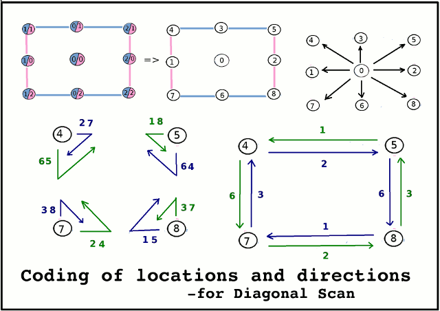
Each
parameter system (for X and
Y) has a
variable flag that signals if the
current value is equal to the
minimum
value, the
maximum
value -or is
between
these values:
The
values for these flags are:
Minimum => 1
Between =>
0
Maximum => 2
Each
location within the (
2-dimensional) scanning
area can thus be
identified
in terms of combinations of the values of these two flags.
I.e.
Minimum, Maximum
(
1,2)
=>
Bottom left corner
Between, Between
(
0,0) =>
Central area
Between, Minimum (
0,1)
=>
Top Horizontal Edge
Dealing with two numbers is rather awkward
--so we
map them into a
single number using the
formula:
Code = (3 x Y-flag) + X-flag:
i.e.
X-flag => 0 1 2 0 1 2 0
1 2
3 x
Y-flag => 0 0 0 3 3 3 6 6 6
--------------------------- +
0 1 2 3 4 5 6 7
8
=> Location Code
---------------------------

